Ø
Topographic
studies and urban planning documentation – phases for Urbanistic Certification
and Urbanistic Zonal Plan for the Filipeşti and Bereşti – Bistriţa region for Wind
Farm – approx. 1000 ha.
Ø
6000
ha of land registration and topographic survey for the design of a Wind Park on
the administrative territory of villages Păltiniş, Viişoara, Coţuşca and
Rădăuţi Prut from Botoşani County.
Ø
Topographic
studies for elaborating the General Urban Plan for different territorial administrative units, in area of approx.
12000 ha.
Ø
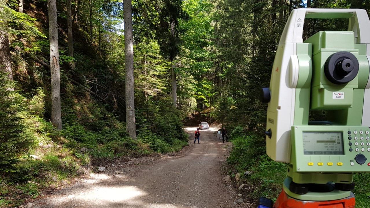
Topographic
studies for “Modernization and rehabilitation of county roads in various
locations, approximate 1.500 km,
Ø
Technical assistance for the preparation of the
financial application and the conducting documentation for the regional project
in the development of the wastewater infrastructure of Neamt County in
2014-2020 for 22 territorial administrative units.
Ø
Technical assistance for the preparation of the
financial application and the conducting documentation for the regional project
in the development of water and wastewater infrastructure of Buzau County in
2014-2020 for 11 territorial administrative units.
Ø
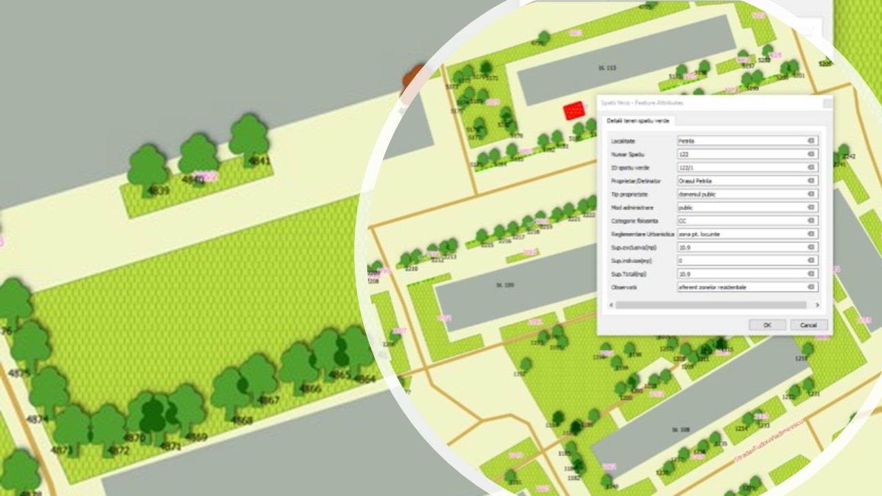
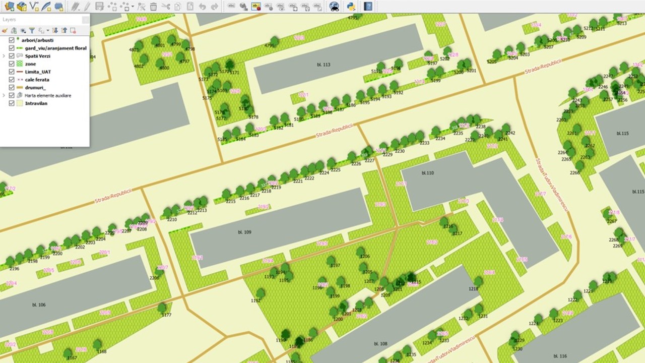
GIS data acquisition and integration in GIS application
– for the urbanization and green space national project “Green Space Registry” approximative
12000 ha.
Ø
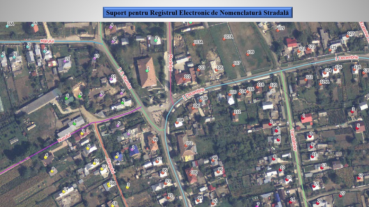
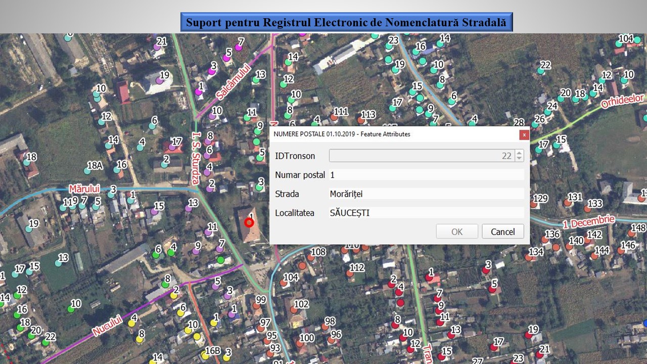
GIS data acquisition and integration in GIS application
for regional administrative authorities complementary with National electronic
registry for streets and postal numbers for approximative 90 territorial
administrative units
Ø
Topographic studies for the expansion of fiber
optic networks (ORANGE and TELEKOM beneficiary) – approx. 6300 km network.
Ø
GIS data collection for regional Electric
Powerlines DelGaz Grid – 18000 km
Ø
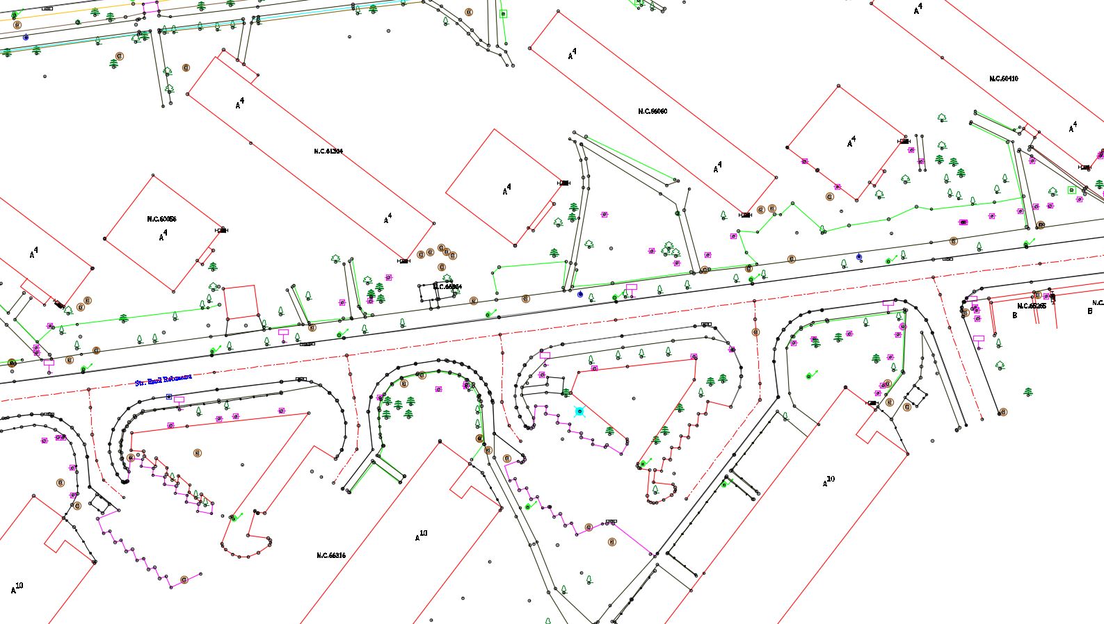
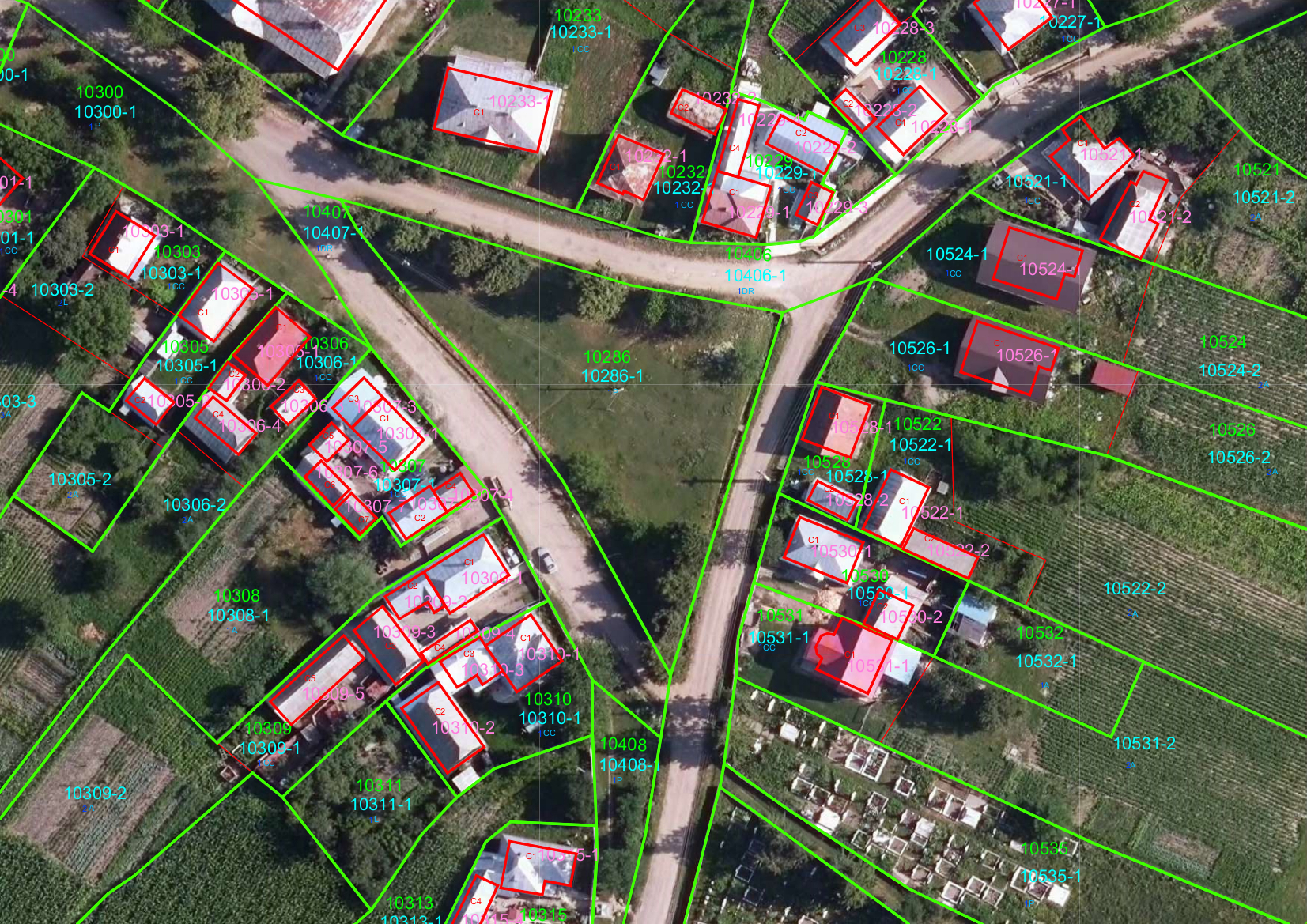
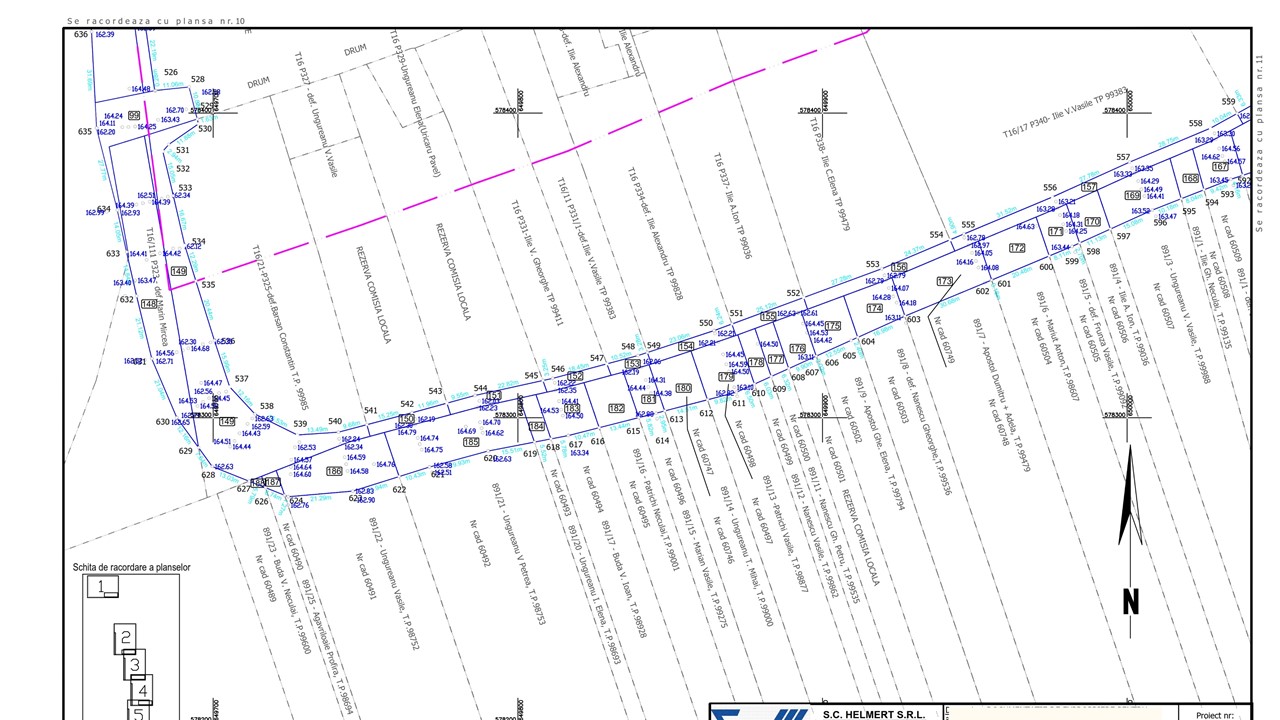
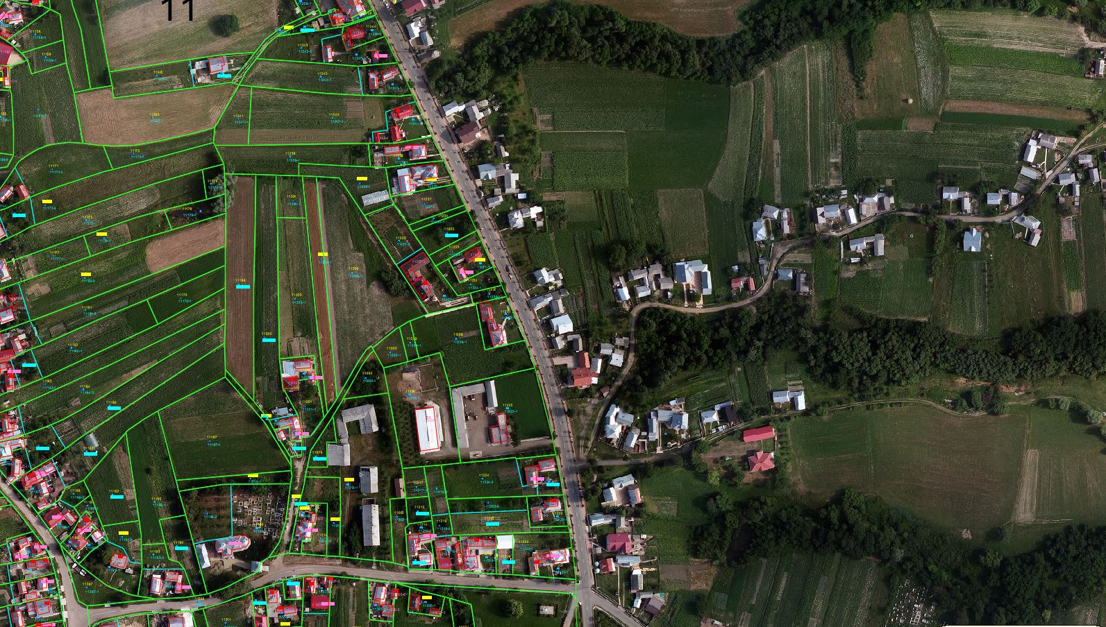
Systematic land registration at the level of territorial
administrative units – aprox.15000 ha
Ø
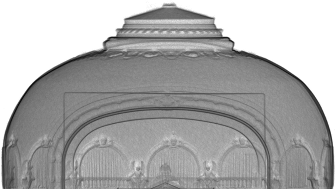
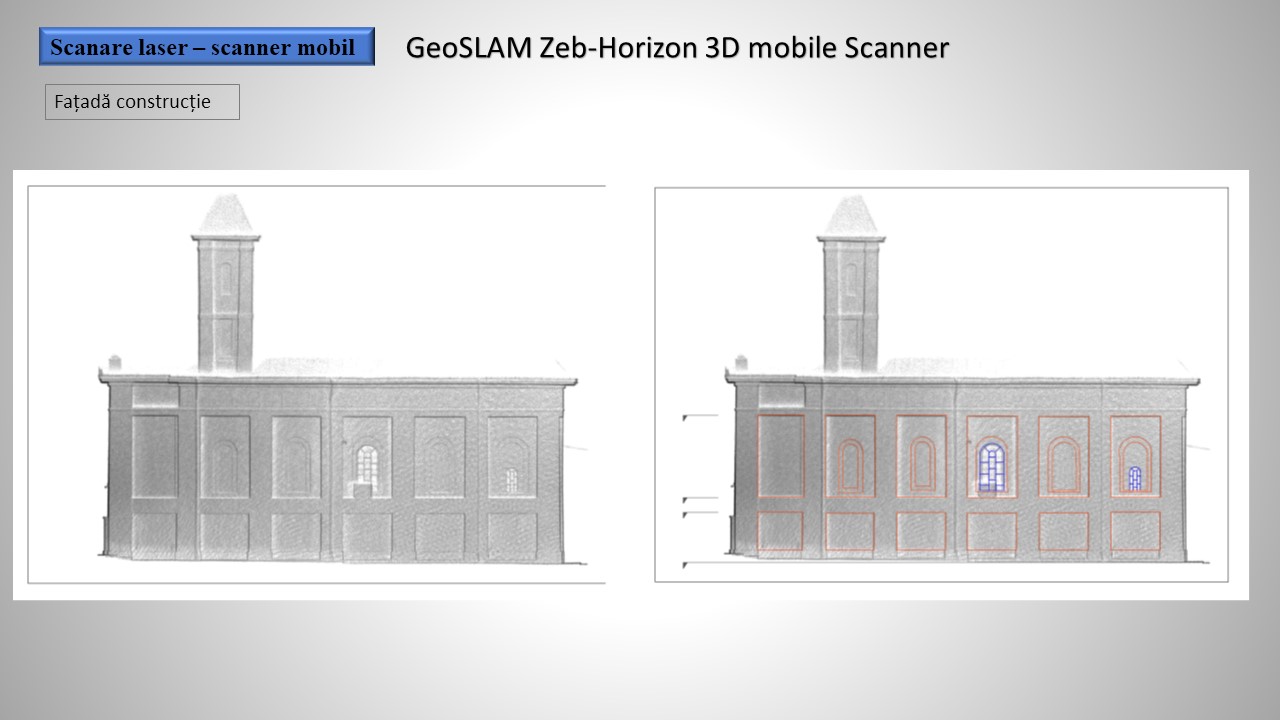
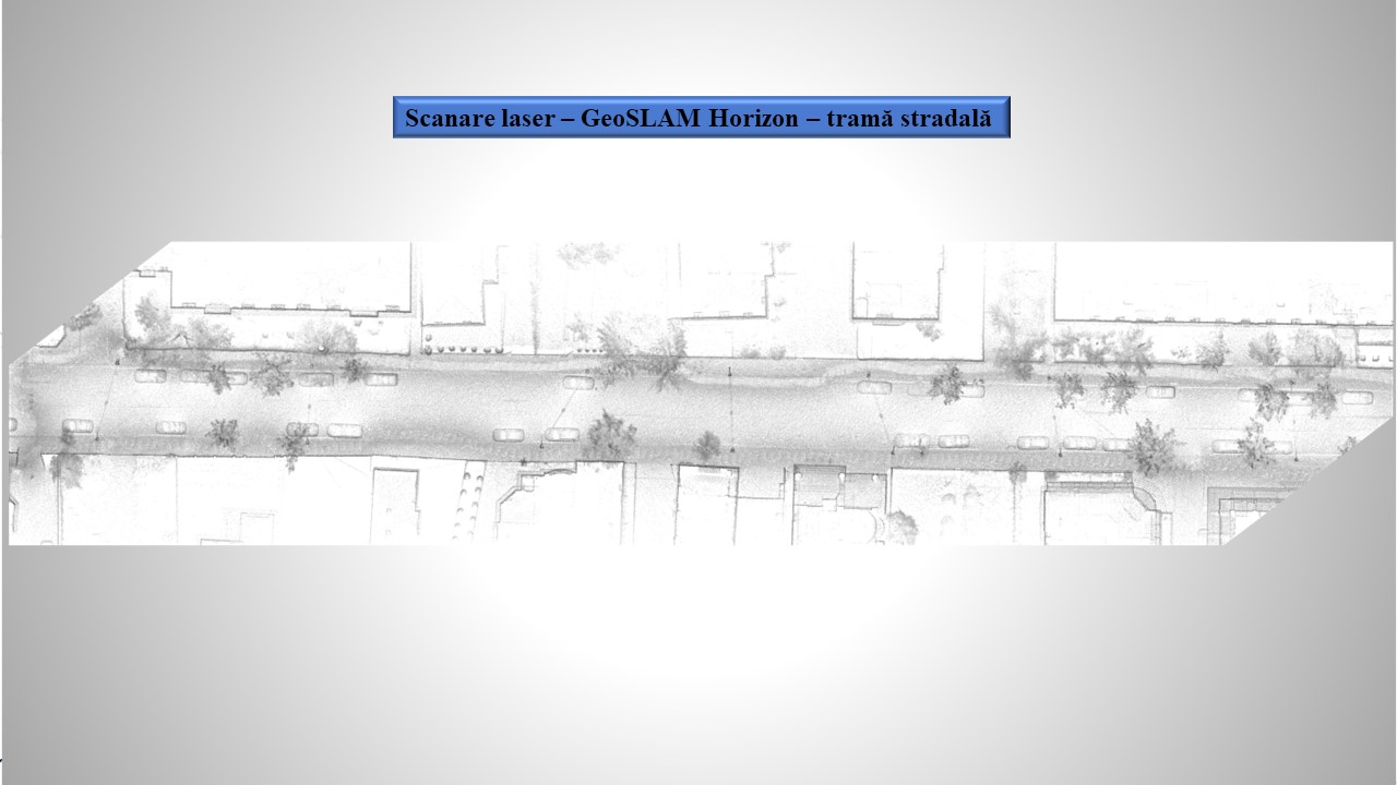
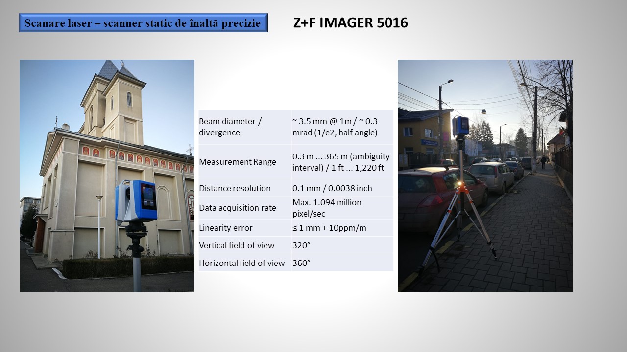
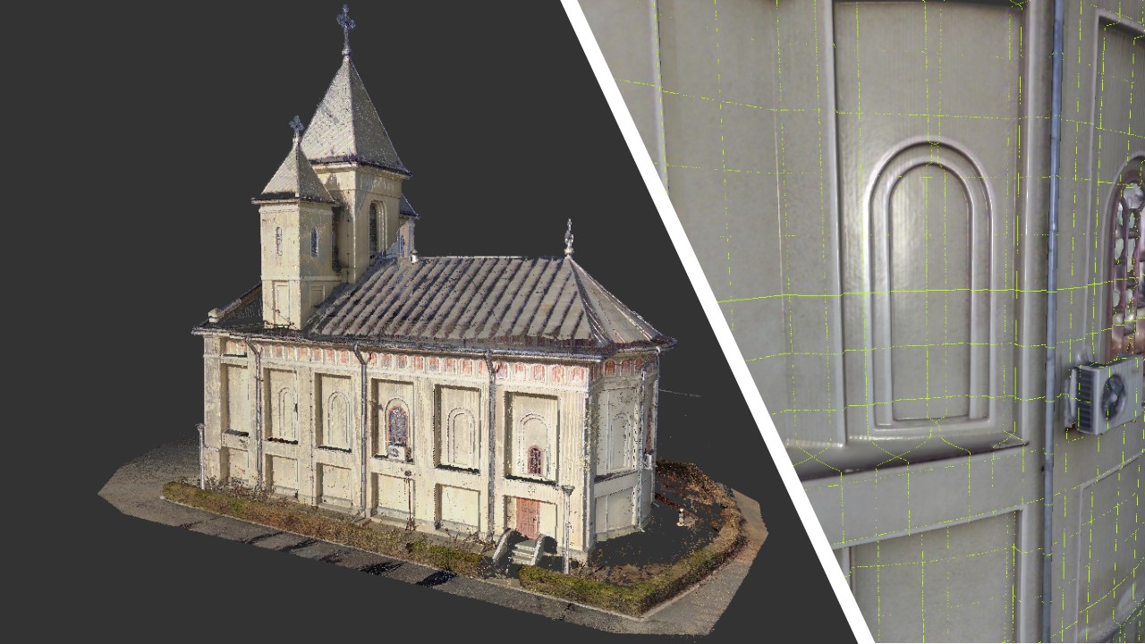
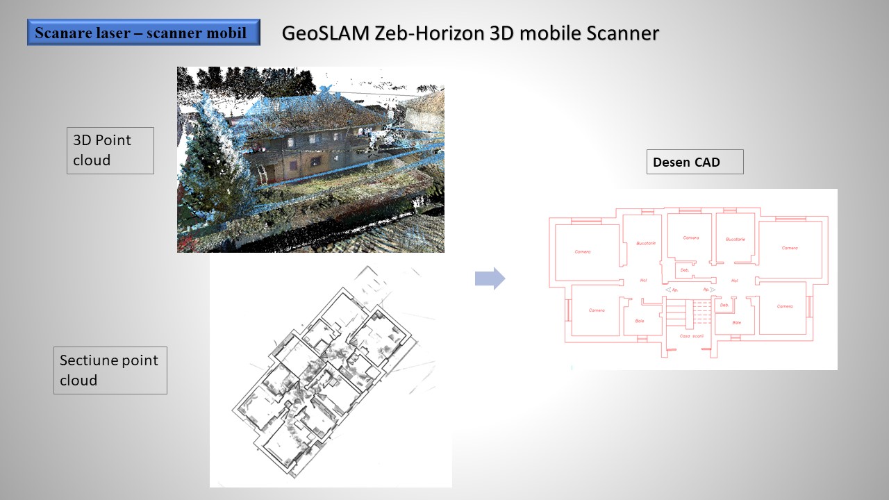
Scanning heritage buildings like the churches in
Magiresti, Orbeni, Darabani, the old mansion of Horgesti, the town hall
building from Racaciuni.
Ø
Topographic studies for the establishment and modernization of road infrastructure: Radauti Belt,
Baia Mare Belt, Baia Mare – Express Road – Satu Mare (new roads) approximative 220
km, modernization of DN 18, DN 28B, DN 7D, DN57, DN 29D, DN 12C and many other approximative
940 km.
Ø
Creation of GIS database for Public County Roads
in Bacau – approx. 876 km.